This narrative is taken from the descriptive notices which the Purser exhibits on the ship’s notice board on the voyage round Africa as the vessel approaches the port of call or point of interest concerned.
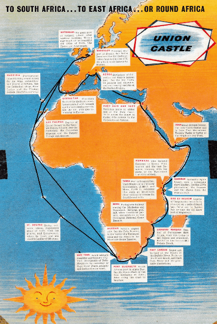
The ports of call between London and Cape Town via the West African Route vary according to the general itinerary of the ship. If calls are made at Ascension and St. Helena after leaving the Canary Islands, the calls at Lobito and Walvis Bay are usually omitted (and vice versa).
Passengers could also obtain from the Bureau a copy of our Folder Map of Africa showing Routes of the Company’s Services, together with booklets giving details of the itineraries and cost of shore excursions at principal ports of call.
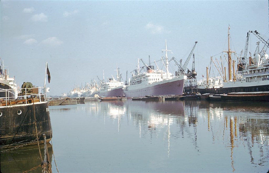
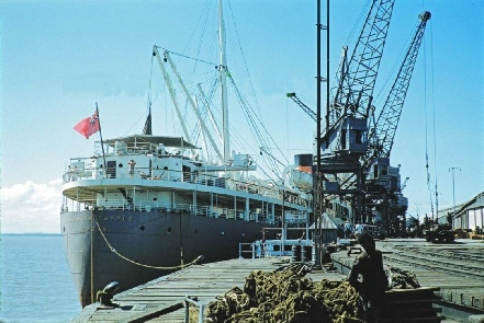
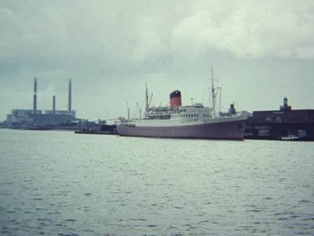
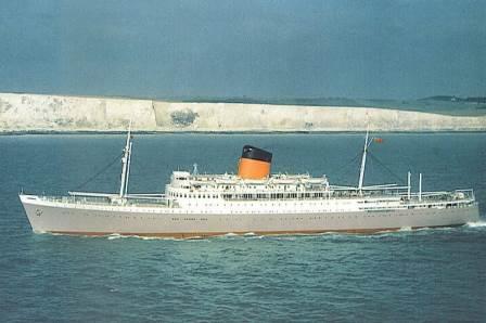
Taken in the mid 1950s. The rare sight of two Intermediates in London’s King George V Dock together.
Braemar Castle is seen with Dunnottar Castle lying astern of her.
An Intermediate (either Kenya, Rhodesia or Braemar Castle) lying in King George V Dock London
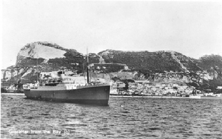
Gibraltar is a mountainous promontory off the south west of Spain and it stands at the entrance to the Mediterranean. It is British Colony, 1,326 miles from London and 695 from Marseilles. The area is about 2¼ sq miles and the civil population is 28,500. The inhabitants are British subjects, but many are of Spanish and Italian descent. The Rock of Gibraltar is separated from Spain by a sandy isthmus about a mile long, across which there is a strip 500 yds wide known as the Neutral Ground, which separates the frontiers. The Spanish town of La Linea lies just beyond the border and thousands of inhabitants come daily to Gibraltar to work.
The highest point of the Rock is 1,396 feet above the sea and from the harbour to the summit it is honeycombed with tunnels and battery emplacements. The eastern and northern faces form an inaccessible precipice rising abruptly from the sea. The town is built on the western side looking over the Bay to the Spanish port of Algeciras.
Place of interest in the town are the two Cathedrals, the museum and Moorish Bath, the Southport Gates, one of which bears the Arms of Charles V of Spain, the Trafalgar Cemetery and the Alameda Gardens. The eighth century Moorish castle above the town is also well worth a visit.
The Gibraltar apes, the last remaining in Europe, may sometimes be seen on the western slopes near Charles V Wall. A legend foretells that when there are no more monkeys left in Gibraltar the British will leave the Rock. During a critical period of the the last war the apes began to sicken and several died. The story is told that “reinforcements” of Barbary apes were flown in from Morocco to keep them up to strength.
Gibraltar was one of the Pillars of Hercules. It was taken by the Moors in 711 and after changing hands more than once, became Spanish in 1462. The Rock was captured in a surprise attack by Sir George Rooke in 1704, and was ceded to Britain by the Treaty of Utrecht in 1713. The great siege of Gibraltar by the combined French and Spanish forces lasted from 1779 to 1783, when it was heroically and successfully defended by Sir George Elliott, who, during the final assault, set fire to most of the enemies floating batteries by means of red-hot cannon balls. In the Versailles Treaty of 1783, Spain agreed to the British occupation of Gibraltar in exchange for East and West Florida and Minorca.
During the Second World war Gibraltar played a very important part. Besides serving as a regular convoy assembly point, it was used as headquarters by the Allies in the initial stages of their invasion of French North Africa.
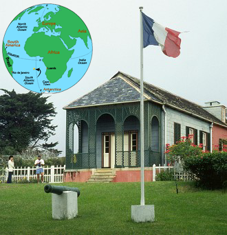
Gibraltar
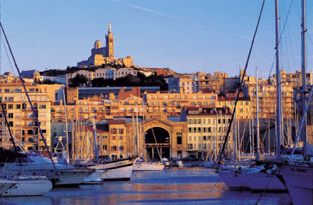
Marseilles is 695 miles from Gibraltar and 201 miles from Genoa. Vessels enter the docks and berth at a quay, whence the City is easily reached by bus.
Marseilles has a population of 750,000 and is the principal seaport and second city of France. It was founded about 600 BC by the Greeks from Asia Minor and soon became a powerful maritime centre. Julius Caesar conquered it in 49 BC and the city remained under Roman rule until the fall of the Western Empire. Thereafter it was ravaged by various invaders until in 1481 it was united to France.
From Marseilles a canal runs to the estuary of the Rhône, 60 miles away.
The famous Chateau D’If, a stern grey fortress, is situated on a rock lying some two miles out from the Old harbour and may be visited in fine weather. The castle was built as a state prison by Francis I, and many important prisoners were confined there. It is best know however in connection with Dumas’ novel The Count of Monte Cristo.
In the city are many notable buildings. Both the Cathedral and Notre Dame de la Garde are modern, but the church of St. Victor, near the Old Port, dates from the thirteenth century and parts are believed to be much earlier. There are also important museums and art galleries.
After leaving Marseilles, the vessel passes a group of picturesque rocks, which guard the entrance to the harbour and long after the city itself is lost to view, the gilded statue of the Virgin of Notre Dame de la Garde remains above the horizon.
Marseilles
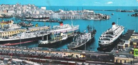
Genoa, 201 miles from Marseilles and 1,438 miles from Port Said is the chief seaport of Italy and has a population of about 800,000. The city is built partly on the lower slopes of the Ligurian Alps and presents a beautiful appearance from the sea.
The vessel lies alongside a quay within easy reach of the town.
Genoa is a very ancient centre of commerce and navigation and has had an eventful history. The city took part in the Crusades, both as a belligerent and in transporting the forces and supplies of her allies. From the eleventh until the fourteenth century, Genoa was the supreme naval and mercantile power of Europe, with ports and fortresses on the Spanish and Barbary coast , in the Levant and on the shores of the Black Sea and the banks of the Euphrates.
The city was conquered by the French in 1684 and in 1746 was occupied for a few months by the Austrians. After many vicissitudes, it became a portion of united Italy under Victor Emanuel II.
Genoa was the birthplace of Christopher Columbus; and it is from here that Garibaldi sailed with his volunteers, in 1860, to take part in the Italian War of Liberation.
Medieval churches and the sixteenth century palaces of the Doges and merchant princes are a feature of the city’s architecture. Some buildings date back to the eleventh century.
The Old Town, which lies between the Upper Town and the old sea front, has changed little with the passing of the centuries. It consists of narrow alleys in which huddled palaces and shops, churches, banks, offices and many-storied houses. It is best visited on foot.
Genoa is rich in its collections of paintings and museums. If time permits, a drive to Portfino and Rapallo, on the Italian Riviera, is recommended.
Genoa
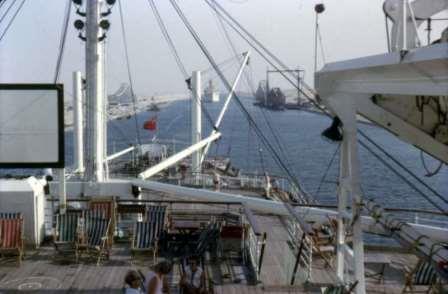
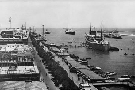
Port Said is 1,438 nautical miles from Genoa and 87 miles from Suez. Vessels are usually moored to buoys and passengers walk ashore over a pontoon.
The town stands at the northern end of the Suez Canal and is built on what was once an isolated portion of a narrow sandbank separating Lake Menzaleh from the Mediterranean. Sand from the Canal works was dumped here, and the area is increases year by year by the deposit of Nile silt.
The Western Mole, the most important part of the harbour works protecting the entrance to the Canal, projects about 3 miles out to sea from the Rue Sultan Hussein, where most of the shipping and mercantile offices are situated.
On the Mole near the western entrance to the harbour is a fine statue of Ferdinand de Lesseps, builder of the Suez Canal.
The coast is low lying and only the lighthouse, the town and shipping are seen from the offing. Most conspicuous are the fine domed offices of the Suez Canal Company.
The population of Port Said is about 178,000 of whom some 20,000 are Europeans. Standing as it does at the gateway between east and west, it is the natural meeting place of men of many races, and cosmopolitan crowds are seen in its streets and bazaars.
The principal shops, which are within easy walking distance, are in Sharia Farouk and Sharia Fouad 1st. These are usually of interest to visitors on account of their varied assortment of Oriental goods.
Cairo is 149 miles by rail from Port Said, and the journey by train takes about 4½ hours. There is also a regular air service, the journey occupying 45 minutes.
Port Said
Suez has a population of about 108,000 (10,000 Europeans) and is 87 miles from Port Said and 703 miles from Port Sudan.
The Gulf of Suez is so shallow that the Canal was forced to take a course close to the eastern shore, and the actual harbour is an artificial construction built on the edge of the shallows from soil excavated from the Canal. The harbour area is known as Port Tewfik and lies two miles from Suez, with which it is connected by a wide causeway.
Opposite Suez is the site where pilgrims to Mecca and other caravans make their camp. The caravan route to Mecca runs eastward across the Peninsula of Sinai through the desert of et-Tin to Akaba, then turns south and follows the eastern shore of the red Sea.
At the north end of the Avenue Helene is a statue of Lieut. Thomas Waghorn RN (born 1800), erected by de Lesseps in 1870. He was originator of the “Overland Mail Service” from India to England via Egypt. Passengers and mails were landed at Alexandria, travelling by canal boat and Nile steamer to Cairo, whence they made the 90 mile journey across the desert to Suez. By proper timing of steamers on both sides of the Isthmus and carry mails overland to and from Marseilles, comparatively rapid communication was maintained with the East. A small portion of the Cape mails was carried by this route between 1864 and 1867, when there was only one monthly mail sailing from Cape Town to England; the connection was made by a Union Line steamer with a P & O vessel at Mauritius.
The Suez Canal commences at Port Said and runs through Lakes Menzaleh, Timsah and the Great and Little Bitter Lakes to Suez, 101 miles (87 nautical miles).
By connecting the Mediterranean with the Red Sea, the distance from England to India is reduced to 7,500 miles as compared with 11,600 miles via the Cape of Good Hope.
As early as about 2000 BC a fresh water canal is known to have existed. Waterborne traffic proceed up the Nile as far as Burbastis (near the modern town of Zagazig) or Memphis (Cairo), and thence by the fresh water canal to Ismailia on Lake Timsah. From there the journey was continued to Suez along a canal, which had been commenced by Necho in 600 BC and completed 100 years later by Darius I. This canal is said to have been fifty yards wide by 17 feet deep, and was partly built of masonry. It feel into disrepair in about 100 BC and was restored by Trajan 200 years later. In about 640 AD it was again restored, this time by the Arabs, being finally abandoned some two centuries later. In more recent times the Venetians, the Mamelukes and the French under Louise XIV and Napoleon, proposed the re-opening of the old canal or the construction of a new one. Napoleon actually commenced but Lepère, his engineer, calculated that the waters of the Red Sea were 33 feet higher than those of the Mediterranean, and this, coupled with the formidable nature of the enterprise caused him to abandon it.
In 1854, the French engineer, Ferdinand de Lesseps, showed Lepère’s levels to be incorrect and submitted plans to Said Pasha, the Viceroy, which were approved; and , in the face of considerable opposition, the Compagnie Universelle du Canal Maritime de Suez was formed. Work started in 1859, and, in the early stages as many as 25,000 men were employed. The Canal was opened on 17 November 1869. Expenditure amounted to £16,000,000 and its cost up to the end of 1934 had amounted to £38,500,000 gold. The British Government’s shareholding, purchased by Lord Beaconsfield from the Khedive in 1875 for approximately £4,000,000, was 176,602 shares, each of 500 francs.
The width of the Canal is from 400 to 500 feet, with a minimum depth of 40 feet. The maximum speed at which a vessel may travel is 7½ knots and the passage, which may be made by day or night takes an average of about 14½ hours.
The Canal and the strip of land on both sides were declared neutral territory in 1888.
On either bank are milestones, those on the east show the distance in miles from Port Said Lighthouse and those on the west show it in kilometres. The railway is on the west bank.
From Port Said the Canal crosses Lake Menzaleh to El Kantara (The Bridge), 24 miles, a point which has been traversed for thousands of years by the caravan route from Egypt to Syria. It was here that the Turks tried to cross the Canal in 1915, and El Kantara was the base of General Allenby’s advance on Palestine. The railway to Jerusalem starts at Kantara East. At El Ferdane, 40 miles from Port Said and 61 miles from Suez, the hills of El Gisr are passed. These, know as “The Embankment”, rise to 52½ feet above the level of the sea, and, it was here that the Canal builders met the principal obstruction. Lake Timsah is next crossed, on which lies Ismailia, 48 miles, called by de Lesseps “ The Inland City of the Seas”. This is an important town with a population of about 25,000. A monument commemorating the services of the Allies in defence of the Canal during the 1914-1918 war is seen on the western bank, south of the town.
Beyond Lake Timsah the Canal takes almost the same line as that followed by Darius I, the remains of one of whose monuments was discovered near the station of Serapem. At 61 miles the Great Bitter Lake is entered, which joins the Little Bitter Lake beyond Kabret, 76 miles. The northern end of the Great Bitter Lake was nearly dry at the time the Canal was opened, and was from 25 to 40 feet below the level of the sea. It is supposed to be somewhere in this neighbourhood that the Israelites crossed the Red Sea, which may in those times have extended far inland.
The Canal leaves the Lakes at 85 miles from Port Said and 16 miles from Suez; and at 88 miles is Shaluf-et-Terebeh where Darius also erected a monument. In this section there are very heavy cuttings through limestone, in which quantities of marine fossils are embedded. At 101 miles the vessel leaves the Canal and arrives alongside the harbour works at Suez.
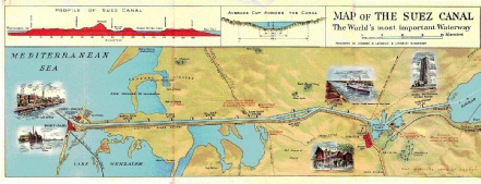
Suez Canal
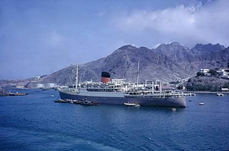
Aden, which lies 671 miles from Port Sudan and 1,632 from Mombasa, was annexed by Great Britain in 1839 after successive occupation by the Abyssinians, the Persians, the early Caliphs and Turks. Until 1937 it was part of the Bombay Presidency, but now it is the Colony of Aden.
The are of the Colony (mainland only) is 75 sq miles. The Island of Perim, in the Strait of Bab el Mandeb, and the five Kuria Muria Islands, off Dhufar Coast of Oman, also form part of the Colony.
Aden consists of tow extinct volcanic craters forming rocky peninsulas. These are know as the Aden and Little Aden Peninsulas, and , joined by a sandy foreshore, make up Aden Bay. The harbour is on Aden Peninsula, an arid, volcanic formation surmounted by Jabal Shamsan, 1,725 feet.
Arab towns near the port are Crater (5 miles) and Sheikh Othman (6 miles).
Vessels lie in the roadstead and passengers land by boat. Over 4,000 ships call annually.
The Colony is on the Asiatic side of the Gulf of Aden; behind it lie the Aden Protectorate and the Arabian Desert.
The population of the colony is about 100,000, mainly Arabs, but including about 500 Europeans.
Rainfall is extremely scanty, and in some years there is none, though as much as eight inches has been recorded. Drinking water was formerly distilled, but in 1929 ample underground water supplies were discovered. The port is an important trading centre; and, on the sandy shores of the Bay, salt is manufactured in considerable quantities by the process of open evaporation.
In a narrow ravine behind the town are the ancient Tawela Tanks, twelve in number, believed to have been built by the Persians. The tanks, which may be visited by car in about one hour, are now more or less empty. Near the tanks is the Museum of Antiquities.
There are bathing facilities at Gold Mohur Bay, three miles from Aden.
Aden
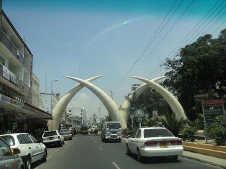
Mombasa Island has an area of 5½ sq miles, and is linked with the nearby mainland by a causeway carrying road and rail traffic. Additional access is provided by a pontoon bridge to the north and ferries to the south. Mombasa is distant from Tanga 83 miles, from Durban 1,987 miles, Aden 1,633 miles and London (via Marseilles and Genoa) 6,754 miles. The rail distance to Nairobi is 330 miles.
The vessel lies alongside a quay at Kilindini, a modern harbour on the south-west side of the Island, with an extensive landlocked anchorage. There is a bus or taxi service to Mombasa Town three miles away.
Mombasa is the starting point of the railway to Uganda, 882 miles long.
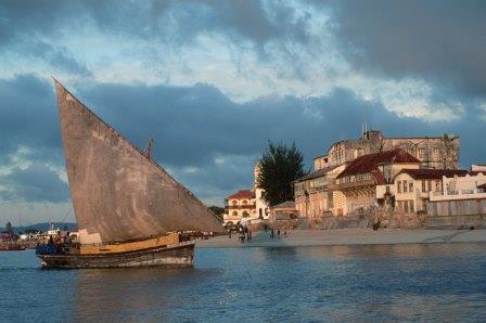
Mombasa Old Port, on the other side of the Island which was used by Arabs, Persians and others for many centuries before the appearance of Europeans in East African waters, Is now used only by small coasters and by the Arab dhows from the Persian Gulf which visit Mombasa in considerable numbers, up to 500 each season. The dhows are picturesque vessels, often with high carved sterns and have altered little in design during the passage of time. They usually arrive in Mombasa between December and April.
The Old Port is guarded by Fort Jesus, an historic Portuguese castle dating from 1593, over which flies the red flag of the Sultan of Zanzibar.
Mombasa was an important centre of Arab power in the eighth century and was first visited by Europeans when Vasco da Gama anchored off the town in 1498. The Portuguese captured the Island in 1505 and since then until 1784, when the Arabs captured Mombasa and Zanzibar, it was frequently attacked by Arabs or Portuguese and several times changed hands. The great siege of Fort Jesus was commenced by the Arabs in March 1696 and terminated with its storming 33 months later and the massacre of its thirteen survivors. A Portuguese relief fleet from Goa arrived two days too late and sailed away learning that the fort had fallen.
For more than a hundred years after the expulsion of the Portuguese in 1784, the East Coast from the Rovuma River to Somaliland was controlled by the Imam of Muscat, whose Viceroy ruled in Zanzibar. During this period, until, under pressure from Great Britain, Seyyid Bargash closed the slave markets in 1873, extensive slave trading was carried on.
The imperial British East India Company received its charter in 1888, and the conflicting interests of Great Britain, Germany and Italy in Eastern Africa were settled by treaty in 1890–1.
Mombasa is now part of Kenya Protectorate, which is a strip of land, extending 10 miles inland, running from the Tanganyika border north to Kipini and including the islands of the Lamu Archipelago. These territories comprise the mainland dominions of the Sultan of Zanzibar, in respect of which a rent of £10,000 per annum is paid to him.
The population of Mombasa is made up of many races, Its 85,000 inhabitants include 2,027 Europeans, 24,000 Indians, 13,500 Arabs, 1,750 Goans and 43,000 Africans.
The Island has Anglican and Roman Catholic Cathedrals, several Mosques and a Hindu Temple and Burning Ghat. Of interest are the two Phallic Towers and several ruined fortifications. On the mainland, near English Point, is the grave of the wife and child of Krapf, the missionary and explorer.
Mombasa’s principal exports are cotton, coffee, tobacco, sisal, pyrethrum, hides and skins, wattle bark and extract, tea, sodium bicarbonate, kyanite, cottonseed, maize, beans and timber.
Mombasa
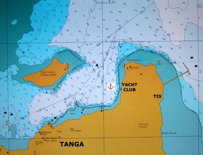
Tanga, 73 nautical miles from Mombasa and 72 miles from Zanzibar, is an important port in Tanganyika.
Vessels lie off the town and passengers land by boat.
The population is about 30,000 of whom 700 are Europeans, 7,000 Asians and 22,000 Africans.
Tanga was founded by the German traveller, Hermann von Wissmann, and is situated on a plateau overlooking the harbour and Tanga bay. It is laid out among avenues of trees including many lofty palms. The northern and western shore of the Bay are bordered by mangroves and at the head of the bay is a mangrove swamp.
There was an earlier settlement on the island in the Bay some half-mile to the north of the harbour, known as Toten Island. A native superstition based on a legend, foretells death to anyone who goes to live on Toten Island and an Arab settlement, and of later years, a German Mission, have had to be abandoned for this reason. The natives regard the place as haunted.
The River Sigi (Mgambo) which runs into Tanga Bay is navigable for a few miles until rapids impede its course.
Tanga is the terminus for the Usambara Railway, which extends 279 miles inland to Moshi and Arusha in the Northern Province. From these stations the magnificent mountains of Kilimanjaro and Meru may be seen.
The town was attacked by the British in November 1914 but they were repulsed with heavy loss, and it was eventually captured by General Smuts in July 1916.
In the vicinity of Tanga are large plantations of coconut palms and sisal. The principal exports are sisal, timber, coconut oil, hides and skins and kapok.
The Amboni Caves, 5 miles from Tanga, are limestone caverns in picturesque surroundings.
Tanga
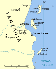
Zanzibar Town, on the island of Zanzibar, is 157 nautical miles from Mombasa and 74 miles from Tanga.
Vessels anchor close in-shore and passengers land by boat.
Zanzibar Protectorate consists of the islands of Zanzibar (640 sq miles) and Pemba (380 sq miles). The total population of the two islands is estimated at about 266,000 about 150,000 of whom live in Zanzibar Island. In Zanzibar Town there are about 46,000 inhabitants; and of the total population of both islands, about 240 are Europeans, 16,000 Indians, 34,000 Arabs. The remainder are Africans.
The early history of Zanzibar is lost in antiquity, and is first referred to in the Periplus in the first century AD. It was in Arab hands at the time of the appearance of the Portuguese, who captured it in 1503. In 1698, with the breaking of the power of the Portuguese on the East Coast, it became subject to the Imam of Muscat, and in 1832, Seyyid Said bin Sultan transferred his capital from Muscat to Zanzibar. He was responsible for the introduction of the clove; and it was during his reign that Zanzibar became both politically and commercially the principal town in East Africa and the proverb quoted here came into use.
From the early times until comparatively recently, Zanzibar was the principal slave market in East Africa. This trade ceased finally only in 1873, when, under pressure from Great Britain, Sultan Seyyid Bargash closed all public slave markets in his dominions. In 1869, the reigning Sultan decreed that all persons entering his territories should be free, and that the purchase and sale of slaves should be prohibited.
In 1890, the Islands of Zanzibar and Pemba were proclaimed as a British Protectorate. The head of the Protectorate is the Sultan, whose plain red flag flies over his palace; and the Government is administered by the British Resident.
In 1896, an attempt was made to seize the Sultanate by Seyyid Khalid, and the Sultan’s palace was bombarded by British warships.
The town and harbour of Zanzibar lie on the western side of the island and are approached by the Zanzibar Channel, which separates it from the mainland some 22 miles away.
Off the port are some coral islands, one of which is known as Grave Island. Here, in a small cemetery, lie British residents and others who have died in Zanzibar since 1811. Among them are officers and men of the Royal Navy killed in action against slave-raiders, and also in the action fought at Zanzibar in September 1914 between HMS Pegasus and the German cruiser Koenigsberg. The others are Bat Island, Prison Island (or Quarantine) and Bawe Island. Chumbe and Pungume Islands lie 8 and 22 miles south of the port respectively and are seen on the voyage to or from Dar es Salaam.
Pemba lies about 30 miles north of Zanzibar and is a fertile and beautiful spot, with a rainfall heavier than that of Zanzibar - almost 80 inches per annum. Off its west coast is the island of Mesale also known as Kidd’s Island, where that pirate is supposed to have buried some of his treasure.
Vessels sailing between Zanzibar and Mombasa normally call at Tanga and pass through the Pemba Channel, which separates Pemba from the mainland.
Native dances are often held, usually in the evenings and His Highness’s Band plays occasionally.
There is much of interest in the Indian and Native Bazaars, where a great variety of curios are offered for sale.
The Victoria Gardens, now open to the public, were laid out by Sultan Bargash for the use of his harem. Also of interest are the Peace Museum and the Mile Stone. The latter is near the Hospitals, and at it are shown distances to local places and to London, 8,064 miles.
Zanzibar
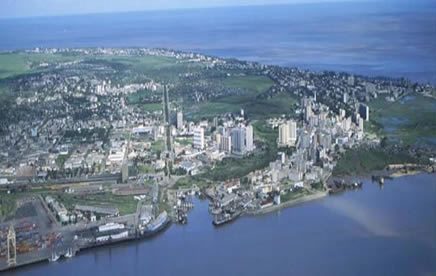
Dar es Salaam (the Haven of Peace) is 45 nautical miles from Zanzibar and 1,003 miles from Beira.
Vessels enter a landlocked harbour through a narrow winding channel and anchor about half a mile off the town. Passengers land by boat.
Dar es Salaam is the principal port of Tanganyika and the seat of Government. The population is about 76,000 of whom 3,603 are Europeans and 19,000 Asiatics.
The town as seen from the sea is exceptionally beautiful. The blue sea, white coral sand of the beaches, green slopes and tall graceful palm trees, combine to make a most striking view. Near the harbour entrance is the wreckage of a floating dock, sunk there by the Germans in 1914 to block the channel.
Dar es Salaam is one of the few towns on the East African Coast of recent origin. It was founded in 1862 by Seyyid Majid, Sultan of Zanzibar and was occupied by Dr Carl Peters, the German traveller, in 1887. A German imperial garrison was established in 1889 when Germany proclaimed a protectorate over what is now Tanganyika.
All differences between European powers regarding East African territory were settled by the Treaties of 1890 and 1891 wherein Great Britain, German and Italy came to an agreement regarding their claims. Boundaries were fixed; Heligoland was ceded by Britain to Germany; and the islands of Zanzibar and Pemba were placed under the protection of Great Britain.
Dar es Salaam was bombarded by the Royal Navy in January 1915; and was surrendered by the Germans on 4 September 1916.
Among the more important buildings are Government House and the Hospital. There is an interesting museum and attractive Botanical Gardens have been laid out between the Hospital and the town.
The Central Railway connects Dar es Salaam with Kigoma 780 miles away on the shores of Lake Tanganyika and Mwanza 768 miles distant, a port on Lake Victoria.
The town has its own African quarter, were coconut palmed avenues, interspersed here and there with clumps of mangoes, are lined with native-built huts.
Native handicraft and curios such as carved wooden figures and bookrests may be purchased from shops in the town.
The principal exports are sisal, coffee, cotton, copra, groundnuts, beeswax, hides and skins.
Bagamoyo, 45 miles north-west of Dar es Salaam, was the terminus of the old slave caravan route to Lake Tanganyika. It was the starting point for several of the famous explorers’ expeditions into the interior, and was, for a short time prior to 1891, the capital of German East Africa.
Dar es Salaam
Beira lies 1.003 nautical miles from Dar es Salaam and 486 miles from Lourenço Marques. Vessels are moored at a modern quay near the town.
Beira is the terminus of the main line to the Rhodesias and the Union. It is 374 miles from Salisbury and 673 miles from Bulawayo. Beira is also the terminus for the Trans-Zambesia Railway, which crosses the Zambesi River 175 miles away by a bridge (12,064 ft in length) and runs through Nayasaland via Blantyre 355 miles to the shores of Lake Nyasa at Chipoka 496 miles.
Beira lies at the mouths of the Pungwe and Busi Rivers and a pilot is taken aboard at the pilot ship 14 miles below the port. The entrance channel leads between sandbanks and both rivers are navigable over a considerable distance for small vessels.
Beira is the gateway to Rhodesia and through its busy harbour passes traffic for Southern and Northern Rhodesia, Nyasaland and the Southern Gongo. Among its principal exports are large tonnages of Southern Rhodesian chrome ore, asbestos and tobacco and Northern Rhodesian copper.
The population of about 42,000 includes 7,000 Europeans of whom approximately 520 are British.
Beira was formerly the capital of Portuguese Territory administered by the Mozambique Company. It is one of the few East African ports of recent date and only came to prominence after the Mozambique Company received its charter in February 1891 (terminated 18 July 1942).
Sofala, however, some thirty miles distant on the south side of the Busi Delta, and now an insignificant settlement, carried on a trade in gold and ivory with the East for centuries before Europeans appeared on the scene. Indeed some claim the Sofala was the Ophir of Old Testament history, whence King Solomon obtained his cargoes of “gold and silver and ivory and apes and peacocks”. At least it is probable that much of the gold of Ophir came from the ancient gold-workings of Rhodesia by way of Sofala.
The Portuguese Fort of San Gaetano commenced at Sofala in 1505, stood until the beginning of the present century, when the walls collapsed owing to undermining by the sea.
The country round Beira is largely flat and low-lying. The town is built on a sandy peninsula between the river and the sea, and the Cheveve embankment scheme had to be undertaken to check the in roads of the sea.
Excursions may be made to Dondo, 20 miles distant, and to Macuti lighthouse, six miles.
The Gorongosa National Game Reserve lies about 100 miles from Beira and contains great herds of animals including elephant, buffalo, hippo, lion etc. It is being developed for the reception of visitors.
The principal local crops are sugar, maize, cotton, coconuts and groundnuts.
Midway between Quelimane and Mozambique are the Primera Islands, a group of islets on the outer edge of the coral bank, lying from five to twelve miles off the Portuguese East African Coast. They are mostly low and sandy and sparsely covered with grass, but Casuarina Island may be recognised at a considerable distance as it is covered with high casuarina trees.
Some 240 miles to the south of Dar es Salaam is the port of Mikinani. About four miles further south still is Mtwara, the new port in Southern Tanganyika.
Beira
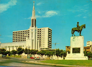
Lourenço Marques is 296 nautical miles from Durban and 486 miles from Beira. It lies on the Bay of Espirito Santo (Delagoa Bay), a fine stretch of water 25¾ miles long by 22 miles broad which is entered on rounding Cape Inhaca (light). The vessel docks alongside a modern quay near the centre of the town.
Lourenço Marques is the terminus on the main line to Pretoria 352 miles, which crosses into the Transvaal at Komati River 55 miles inland.The town is the capital of Portuguese East Africa and has a population of about 92,000 of whom 23,500 are European. It is a modern city, built on rising ground, with broad, tree-lined street and fine buildings.
The beautiful Polona Beach, on the eastern edge of the town, with its picturesque background of red cliffs and masses of luxurious vegetation, is one of the finest stretches of sand on the southern african coast.The cooler months are from May to September, and the town is a popular resort particularly for visitors from the Transvaal.
Lourenço Marques has much of the atmosphere of the Continent, with its boulevards, mosaic pavements, and open air cafes, and the cosmopolitan crowds seen in the streets. There are night-clubs both in Lourenço Marques and at points a few miles along the Beach Road.Delagoa Bay was first visited by Europeans when one of Vasco da Gama’s captains put in there in 1502; and the town takes its name from Lourenço Marques, a Portuguese trader who settled in the vicinity in 1544. Over a long period, the Portuguese sent a vessel yearly to Delagoa Bay from Mozambique, but this was discontinued early in the eighteenth century. A Dutch settlement in 1721 was withdrawn several years later after suffering very heavy losses from fever. A party of Austrian traders who established themselves in 1777 were expelled by the Portuguese in 1781 and in 1787 the Portuguese built and occupied a small fort on the site of the present town. During the last century, recurring disputes between the Portuguese and British regarding occupation of the territory led, in 1875, to the French President, Marshall MacMahon, being asked to arbitrate. His decision was in favour of Portugal. The railway connecting Lourenço Marques with Pretoria was opened in 1895.
Places of interest to visitors are the Botanical and Zoological Gardens, the Cathedral, the Town Hall, the Museum and the Chinese Temple.
Principal shipments made at Lourenço Marques are coal, chrome ore, asbestos, copper, sugar, copra, sisal, vegetable oils and citrus.
Lourenco Marques
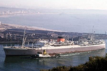
Durban is 255 miles from East London by sea and 296 miles from Lourenço Marques. Rail distance to Johannesburg 494 miles. It is the port and largest city of Natal and a growing industrial centre.
Vessels enter narrow entrance between the Bluff and the Point and berth at a quay. A bus service operates between this area, known as the Point and all parts of the City.
Durban was founded in 1824 and now has a population of 440,166 which includes 133,417 Europeans, 149,994 Asiatics and 141,174 Natives. The town has its Indian quarter and has a more cosmopolitan population than will be found elsewhere in the Union.
The principal residential area is on the Berea, the ridge of hills which overlooks the town.
The chief exports are sugar, wool, hides and skins, wattle bark and other tanning materials, coal and manganese.
Visitors’ Information Bureau at corner of East and Church Streets.
Representatives from the Durban Publicity Association and from firms offering sight-seeing tours, board the vessel on arrival and will give information to passengers.
Durban
East London is 133 miles from Port Elizabeth by sea and 255 miles from Durban. Rail distance from Johannesburg 644 miles. Vessels enter Buffalo Harbour and lie on the East Bank of the Buffalo River within easy reach of the centre of the city by bus or taxi.
East London was founded on the West Bank of the river in 1847, but the construction of the railway on the East Bank soon led to the transfer of the majority of the population to that side.
The population is 96,000 of whom 43,780 are Europeans, 5,800 Coloured and 45,000 natives.
Exports are principally wool, hides and skins, citrus and boxwood.
Visitors’ Information Bureau in the City Hall, Oxford Street
East London
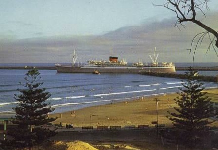
Port Elizabeth is 422 miles from Cape Town by sea and 133 miles from East London. Rail distance from Johannesburg 714 miles. Vessels lie alongside a quay close to the centre of the city.
Port Elizabeth is an important commercial and industrial centre and the second largest town in Cape Province.
It dates as a town from 1820 when over 3,000 British settlers were landed on the sandy shores of Algoa Bay. As a military station it goes back to 1799.
Overlooking the city and the Baakens River is Fort Frederick and, in a conspicuous position near the lighthouse is a stone pyramid, the Memorial to Lady Elizabeth Donkin from whom the port takes its name.
Visitors should see the famous Snake Park.
The population is 215,416 of whom 83,181 are Europeans, 46,113 Coloured and 78,953 Natives.
The principal exports are wool, hides and skins, mohair, citrus and deciduous fruits.
Visitors’ Information Bureau in the City Hall, Market Square.
Port Elizabeth
Vessels berth alongside a quay in Table bay Docks within easy reach of the city by bus or taxi.
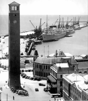
Cape Town is the Mother City of the Union of South Africa, for it was there in 1652 that Jan van Riebeeck founded the first settlement for the Dutch East India Company. It is now the Union’s Parliamentary capital and principal seaport and an important industrial centre.
In size of population the city is second only to Johannesburg, the latest figures for Cape Town being 632,987 of whom 267,212 are Europeans and 297,645 are Coloured.
Table Mountain, which overlooks the city, is 3,549 feet high. To the left, as viewed from the docks, is the Devil’s Peak, 3,300 feet. To the right are Signal Hill, 1,100 feet and Lion’s Head, 2,175 feet.
The most important of Cape Town’s many links with its past history is the Castle, the foundation stone of which was laid in 1666.
The principal exports are citrus and deciduous fruit, dried fruit, jam, canned fruit and fish, wine, wool, skins and hides and Namaqualand copper.
Rail distances: To Johannesburg 956 miles; Pretoria 999 miles; Bulawayo 1,355 miles; Salisbury 1,654 miles.
Visitors Information Bureau in Lower Adderley Street, near the Station.
Cape Town
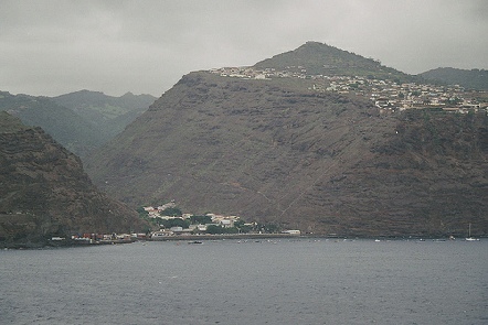
St. Helena is of volcanic origin and has an area of 47 sq miles. Except at very few points, which are covered by ruined batteries, the Island is surrounded by sheer cliffs. The highest point is Diana’s Peak, 2,704 ft and the hill which is seen as the vessel approaches the anchorage, crowned with a fort and towering above its surroundings, is High Knoll, 1,900 ft.
Despite St. Helena’s barren appearance from the sea, the interior is beautifully green and contains magnificent scenery. Out of about 4,750 inhabitants approximately 50 are Europeans. The only important industry is the cultivation of flax.
Vessels anchor about 700 yds from the shore and passengers land at the steps below the battery on Munden’s Point. Jamestown, the capital, lies in a narrow ravine between Munden’s Hill and Ladder Hill, and visitors enter it by way of a bridge over a moat and through a portcullised gateway. Buildings of interest in the town are the Castle and St. Jame’s Church. From Jamestown, up Ladder Hill to the old signal station runs the famous Jacob’s Ladder, a formidable stairway ascending 600 ft in 699 steps, so steep as to cause giddiness. The stairway is in constant use by the Islanders as they go to and fro to their villages beyond.
St Helena was uninhabited when discovered by the Portuguese in 1502 and her first resident, Dom Fernando Lopez, landed in 1515. He was a Portuguese renegade, mutilated by having his nose and ears cut off, who escaped from a ship homeward bound from Goa. He hid in the woods rather than return to Portugal. For many years he lived in a cave in Chapel Valley, where Jamestown now stands, disappearing inland when ships called, until the King gave him a safe-conduct to return to Portugal. But soon, at his urgent petition, he was returned to St. Helena where he died in 1545.
After this there were no permanent residents on the Island for more than a hundred years, but it continued to be a frequent calling place for ships, Portuguese, Dutch and English, homeward bound from the East, which put in for fresh water and to hunt down the wild hogs for provisions.
In 1633, St. Helena was claimed by the Dutch but it was not occupied until 1658 when the English East India Company established a fort there under Captain John Dutton.
In January 1673 it was captured by the Dutch but four months later it was re-taken by Sir Richard Munden.
Thenceforeward it remained in the possession of the English East India Company until kit was taken over by the Crown in 1834.
Napoleon arrived at St. Helena in October 1815; he died there in 1821 and his body returned to France in 1840.
His house at Longwood and his original grave may be visited, and passengers hiring cars for this excursion are advised to arrange their return by way of Sandy Bay Ridge (allow two hours). There from an altitude of over 2,200 ft they will be rewarded with an astonishing view of part of a volcanic crater, running down to the sea, in which are the Gates of Chaos and the curious rocks, “Lot” and “Lot’s Wife”.
Visitors are invited to inspect the Exhibition of handicrafts in Jamestown, which provide employment for many of the island women.
St Helena
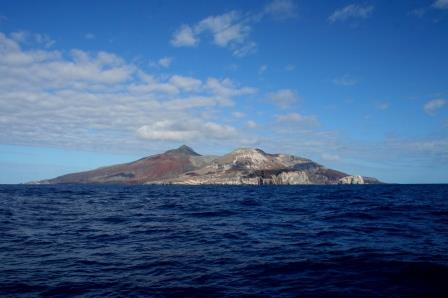
Ascension is of volcanic origin and presents a striking and inhospitable appearance from the sea. It has an area of 34 sq miles and consists of about 40 cones, the highest of which is Green Mountain (2,817 ft), conspicuous for the vegetation on its upper slopes in contrast to the lava and clinker of the rest of the island.
The vessel anchors in Clarence Bay about half a mile from Georgetown. Overlooking the settlement is Cross hill (880 ft) surmounted by two guns taken out of HMS Hood. On Cross Hill is the Redpole Monument, a white obelisk which commemorates the death, in 1817, of Commander J.T. Pasley RN of HMS Redpole, a sloop on the then St. Helena Station. At the foot of the hill is Fort Thornton, close to the Tartar Rock, which juts into the sea near the jetty.
Some three miles away to the south is Wideawake Air Field, built by the Americans during the Second World War to enable aircraft to fly from the United States to the battlefields of Northern African via Brazil, Ascension and Liberia. The aerodrome buildings are visible shortly before the vessel reaches the anchorage from South Africa or on leaving it on the outward voyage. The American Forces left the island in 1947. Ascension was discovered by the Portuguese on Ascension Day, 1501. It remained uninhabited until 1815, the year of Napoleon’s arrival at St. Helena, when the British Government took possession of it. In 1821 it was garrisoned by the Royal Marines. Until 1922, when the garrison was withdrawn, the Island was rated as HMS Ascension and was governed by a Naval Officer. Now it is a dependency of St. Helena and is occupied only by employees of Cable and Wireless Ltd., With their families and servants, in all about 175 persons.
Some vegetables are grown on the slopes of Green Mountain; there are a few cattle and plenty of fish, but the inhabitants largely depend upon imported provisions.
The Island is frequented by sea turtles, which go there to lay their eggs and about a hundred turtles are shipped to England each year used to provide Ascension’s only export; but this has ceased. The turtles weigh from 400 to 800 lb each.
Bird life abounds and adjoining the Air Field is Wideawake Fair, the nesting place of thousands of sooty terns (wideawakes). Other sea birds which may be seen are man-of-war birds, gannets and the boatswain bird; and around the vessel are usually shoals of small fish, commonly known as Black Fish.
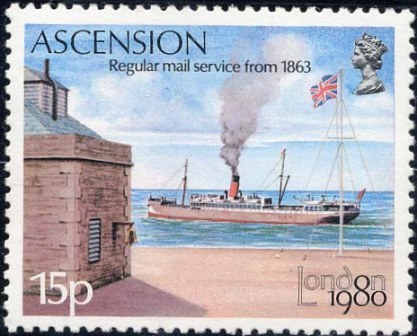
Ascension has its own issue of postage stamps which may be purchased from officials who come on board or from the Post Office in St. Helena.
Communication with the shore is liable to be interrupted without warning by heavy rollers and passengers may not land without special permission from the Magistrate of the Island and the Master of the vessel.
Ascension Island
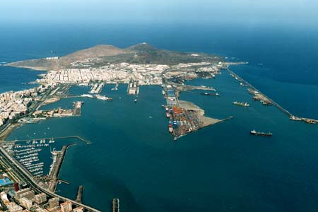
The vessel berths alongside a quay at Puerto de la Luz, the largest p;ort belonging to Spain and one of the most important bunkering ports in the world.
Four miles away by car or bus is Las Palmas capital of the Island of Grand Canary. A city of 143,000 inhabitants including about 250 British. It was founded by Juan Rejon one of the Spanish conquerors soon after his landing in 1478.
Grand Canary, one of the Fortunate Isles of the Romans, has about 300,000 inhabitants. It is roughly circular in shape. The area is 634 sq miles and the highest point is Los Pechos at 6,401 ft.
The island affords a great variety of scenery and has been described as a continent in miniature. There are fine mountain ranges intersected by ravines, volcanic craters, smiling villages and closely cultivated slopes, and in the south is dry desert-like country, some of it difficult to access.
Exports are principally tomatoes, potatoes and bananas; also almonds, onions, hides, cochineal and dried fish. The production of the cochineal insect was formerly a major industry, but as a result of the development of the aniline dye, this has largely given place to bananas.
Before the Spanish conquest of the island in 1483 the inhabitants were the Guanches, a tall fine race, of whom many relics remain. A remarkable collection of mummies, pottery etc excavated from their caves and burial mounds may be seen at 29 Calle de Dr.Chil, Las Palmas.
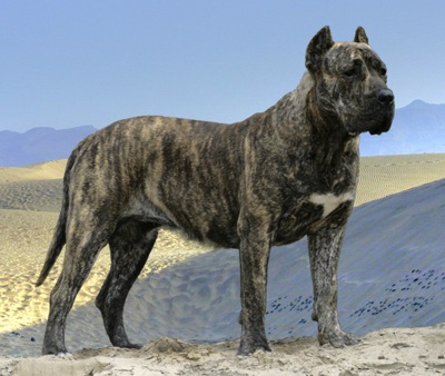
The name “Canary” has no connection with the bird of that name, but is derived fro the Latin (canis : dog).
The Canary Island dogs were large, ferocious animals and now are almost extinct, though there are still a few on the Island of Fuerteventura.
Bronze figures of the dogs (mastiff type) may be seen on the square opposite the Cathedral in Las Palmas.
Visitors wishing to see something of the beauties of the island should take one of the advertised drives into the country.
Las Palmas itself is of considerable interest. The imposing Cathedral with twin towers, dates from the fifteenth century and many examples of old Spanish architecture with typical overhanging wooden balconies will be found in the city.
The Model Canary Village (Pueblo Canario) is a most attractive reproduction of seventeenth century architecture and adjoins the municipal park.
Pelota, a novel and exciting Basque ball game, is played in a specially constructed hall in Las Palmas, and may be seen at certain times daily.
Las Palmas has good hotels and splendid bathing beaches. It lies within five days journey of England by sea and has much to offer the holiday-maker who is in search of something new.
Las Palmas
After leaving the muddy waters of the Thames Estuary, the vessel rounds the Kentish coast off North Foreland and passes through a stretch of comparatively sheltered waters known as the Downs.
On the port side lie the notorious Goodwin Sands, consisting of quicksands which stretch for about 8 miles and are for the most part dry at low tide. On the starboard side the vessel passes the holiday resorts of Margate, Ramsgate, Deal, Folkstone and the old Cinque Port of Dover.
Sixteen miles farther on from Dover and its famous White Cliffs is the lighthouse of Dungeness Point (140 ft). It is here that Trinity House, the pilotage authority for the Port of London, have their pilot cutter and that London ships stop to pick up or drop their pilots.
The vessel now enters the widening waters of the English Channel, passing the Sussex towns of Hastings, St. Leonards and Eastbourne. Beyond Eastbourne are the tall cliffs of Beachy Head.
The vessel turns to the south-westward and shapes a course down Channel towards the coast of France. On a clear day the Isle of Wight is visible with the tall masts of Niton radio station on its skyline. This is the last glimpse that ships from London have of the coast of England.
The vessel now passes through an area which, during the Normandy landings was known as “Piccadilly Circus”, so named because it was the focal point where all swept convoy channels converged.
Off the north-western side of the Cherbourg Peninsula are the Channel Islands of Alderney, Guernsey and Sark with their off-lying rocks and shoals. Fringing these to the north lies a group of dangerous rocks known as the Casquets. On the largest of these, 90 feet above the sea, is a lighthouse. The vessel passes within a few miles of the Casquets, and on a clear day Cape de la Hague, on the tip of the Cherbourg Peninsula, and the islands of Guernsey and Alderney may be seen.
The vessel then passes down Channel towards the French island of Ushant.
Ushant, a French island lying off the coast of Brittany 422 miles from London, marks the northern limit of the Bay of Biscay.
The Island is just over four miles long by two miles wide, surrounded by rugged cliffs and accessible at only a few points. Dangerous reefs, which stretch out into the sea have been responsible for many shipwrecks in the past, and even now, though Ushant has several lighthouses, modern fog-signalling appliances, and the ocean bed is fully charted, it is seaman like to give it a wide berth.
Most of the inhabitants, who number about 2,800, are engaged in fishing and farming.
Two naval actions, both between English and French fleets, have been fought off Ushant. The first, which took place on 17 July 1778, was indecisive, and was remarkable for the fact that, although two fleets each of thirty ships were engaged for three hours, neither side lost a vessel. The other battle took place in 1794, when Lord Howe gained the victory known as the “Glorious First of June”.
The English Channel
Back to London
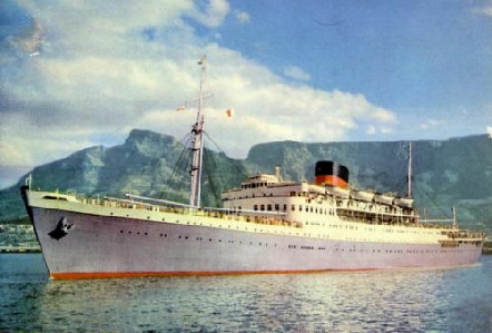
The Intermediate’s Service
Round Africa
|
Passage at 17 Knots
|
Distance
|
Days
|
Hours
|
|
Dungeness Pilot Station to Las Palmas
|
1603
|
3
|
22
|
|
Passage at 17 Knots
|
Distance
|
Days
|
Hours
|
|
Las Palmas to Ascension Island
|
2205
|
5
|
10
|
|
Passage at 17 Knots
|
Distance
|
Days
|
Hours
|
|
Ascension Island to St Helena
|
708
|
1
|
18
|
|
Passage at 17 Knots
|
Distance
|
Days
|
Hours
|
|
St Helena to Cape Town
|
1704
|
4
|
4
|
|
Passage at 17 Knots
|
Distance
|
Days
|
Hours
|
|
Cape Town to Port Elizabeth
|
425
|
1
|
1
|
|
Passage at 17 Knots
|
Distance
|
Days
|
Hours
|
|
Port Elizabeth to East London
|
133
|
|
8
|
|
Passage at 17 Knots
|
Distance
|
Days
|
Hours
|
|
East London to Durban
|
256
|
|
15
|
|
Passage at 17 Knots
|
Distance
|
Days
|
Hours
|
|
Durban to Lourenco Marques
|
296
|
|
18
|
|
Passage at 17 Knots
|
Distance
|
Days
|
Hours
|
|
Lourenco Marques to Beira
|
488
|
1
|
5
|
|
Passage at 17 Knots
|
Distance
|
Days
|
Hours
|
|
Beira to Dar es Salaam
|
1000
|
2
|
11
|
|
Passage at 17 Knots
|
Distance
|
Days
|
Hours
|
|
Dar es Salaam to Zanzibar
|
45
|
|
3
|
|
Passage at 17 Knots
|
Distance
|
Days
|
Hours
|
|
Zanzibar to Tanga
|
72
|
|
4
|
|
Passage at 17 Knots
|
Distance
|
Days
|
Hours
|
|
Tanga to Mombasa
|
73
|
|
4
|
|
Passage at 17 Knots
|
Distance
|
Days
|
Hours
|
|
Mombasa to Aden
|
1632
|
4
|
0
|
|
Passage at 17 Knots
|
Distance
|
Days
|
Hours
|
|
Aden to Suez
|
1303
|
3
|
5
|
|
Passage at 8 Knots
|
Distance
|
Days
|
Hours
|
|
Suez to Port Said
|
87
|
|
12 to 16
|
|
Passage at 17 Knots
|
Distance
|
Days
|
Hours
|
|
Port Said to Genoa
|
1424
|
3
|
12
|
|
Passage at 17 Knots
|
Distance
|
Days
|
Hours
|
|
Genoa to Marseilles
|
201
|
|
12
|
|
Passage at 17 Knots
|
Distance
|
Days
|
Hours
|
|
Marseilles to Gibraltar
|
695
|
1
|
17
|
|
Passage at 17 Knots
|
Distance
|
Days
|
Hours
|
|
Gibraltar to Dungeness Pilot Station
|
1222
|
3
|
0
|
Embarking passengers at Tilbury Landing Stage
Passing Dover enroute to the Dungeness Pilot Station